
La Cazuela topographic map
Interactive map
Click on the map to display elevation.
About this map
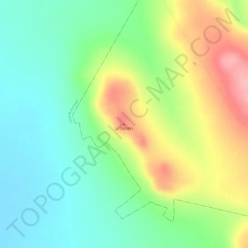
Name: La Cazuela topographic map, elevation, terrain.
Average elevation: 2,269 m
Minimum elevation: 2,215 m
Maximum elevation: 2,347 m
Other topographic maps
Click on a map to view its topography, its elevation and its terrain.
San Luis Potosí
México > San Luis Potosí > Municipio de San Luis Potosí
San Luis Potosí, Municipio de San Luis Potosí, San Luis Potosí, 78001, México
Average elevation: 2,004 m