
Vistabella topographic map
Interactive map
Click on the map to display elevation.
About this map
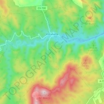
Name: Vistabella topographic map, elevation, terrain.
Location: Vistabella, Campo de Cariñena, Saragosse, Aragon, Espagne (41.18533 -1.19457 41.23296 -1.12135)
Average elevation: 891 m
Minimum elevation: 716 m
Maximum elevation: 1,177 m