
Village of Laurel Hollow topographic map
Interactive map
Click on the map to display elevation.
About this map
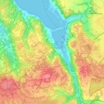
Name: Village of Laurel Hollow topographic map, elevation, terrain.
Average elevation: 46 m
Minimum elevation: -1 m
Maximum elevation: 87 m
Other topographic maps
Click on a map to view its topography, its elevation and its terrain.
Village of Valley Stream
Estados Unidos da América > Nova Iorque > Nassau County
Village of Valley Stream, Town of Hempstead, Nassau County, Nova Iorque, 11580, Estados Unidos da América
Average elevation: 7 m