
Mesía topographic map
Interactive map
Click on the map to display elevation.
About this map
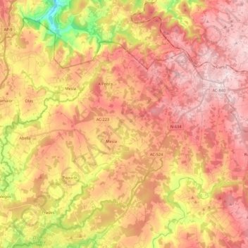
Name: Mesía topographic map, elevation, terrain.
Location: Mesía, Ordes, A Corogne, Galice, 15685, Espagne (43.02024 -8.37259 43.16141 -8.15846)
Average elevation: 389 m
Minimum elevation: 123 m
Maximum elevation: 564 m