
Lemke topographic map
Interactive map
Click on the map to display elevation.
About this map
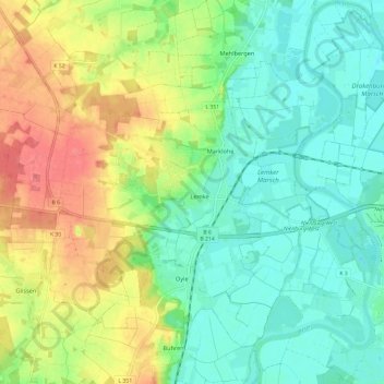
Name: Lemke topographic map, elevation, terrain.
Average elevation: 43 m
Minimum elevation: 17 m
Maximum elevation: 89 m
Other topographic maps
Click on a map to view its topography, its elevation and its terrain.
Oyle
Deutschland > Niedersachsen > Landkreis Nienburg/Weser > Marklohe
Oyle, Marklohe, Samtgemeinde Weser-Aue, Landkreis Nienburg/Weser, Niedersachsen, Deutschland
Average elevation: 45 m