
Targovishte topographic map
Interactive map
Click on the map to display elevation.
About this map
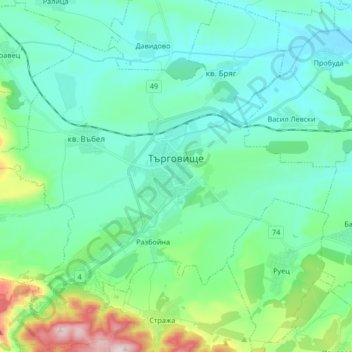
Name: Targovishte topographic map, elevation, terrain.
Location: Targovishte, Bulgaria (43.18457 26.48166 43.30536 26.64970)
Average elevation: 237 m
Minimum elevation: 133 m
Maximum elevation: 668 m
Other topographic maps
Click on a map to view its topography, its elevation and its terrain.