
Andur topographic map
Interactive map
Click on the map to display elevation.
About this map
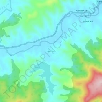
Name: Andur topographic map, elevation, terrain.
Location: Andur, Gaganbavda, Kolhapur, Maharashtra, 416206, India (16.60608 73.91275 16.64608 73.95275)
Average elevation: 615 m
Minimum elevation: 551 m
Maximum elevation: 845 m
Other topographic maps
Click on a map to view its topography, its elevation and its terrain.
Gaganbavda
India > Maharashtra > Gaganbavda
Gaganbavda, Kolhapur, Maharashtra, 416006, India
Average elevation: 469 m