
Buchałów topographic map
Interactive map
Click on the map to display elevation.
About this map
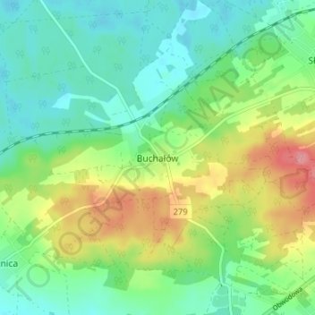
Name: Buchałów topographic map, elevation, terrain.
Average elevation: 121 m
Minimum elevation: 90 m
Maximum elevation: 183 m
Other topographic maps
Click on a map to view its topography, its elevation and its terrain.
Cigacice
Poland > Lubusz Voivodeship > Zielona Góra County
Cigacice, gmina Sulechów, Zielona Góra County, Lubusz Voivodeship, 66-131, Poland
Average elevation: 67 m