
Allegheny Portage Railroad National Historic Site topographic map
Interactive map
Click on the map to display elevation.
About this map
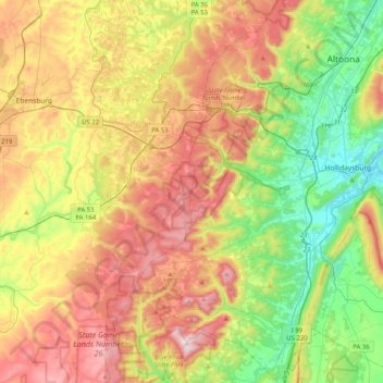
Name: Allegheny Portage Railroad National Historic Site topographic map, elevation, terrain.
Average elevation: 570 m
Minimum elevation: 280 m
Maximum elevation: 957 m
A skew arch bridge, a masterwork of cut stone construction, is another feature of the site near the Lemon House. The bridge is 60.4 feet (18.4 m) long on the south elevation, 54.9 feet (16.7 m) long on the north elevation, and 22.2 feet (6.8 m) high. It was the only bridge on the line that was built to carry a road.