
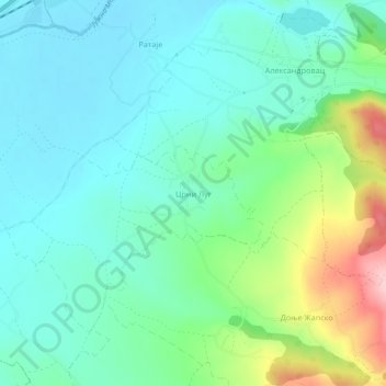
Crni Lug topographic map
Interactive map
Click on the map to display elevation.
About this map
Name: Crni Lug topographic map, elevation, terrain.
Average elevation: 431 m
Minimum elevation: 382 m
Maximum elevation: 573 m
Other topographic maps
Click on a map to view its topography, its elevation and its terrain.
Dubnica
Serbia > Central Serbia > Pcinja Administrative District > City of Vranje > Dubnica
Dubnica, City of Vranje, Pcinja Administrative District, Central Serbia, Serbia
Average elevation: 529 m