Geolocate

Homorod topographic map

Click on the map to display elevation.

About this map

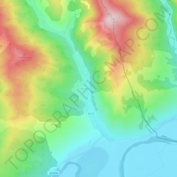
Name: Homorod topographic map, elevation, terrain.

Location: Homorod, Geoagiu, Hunedoara, 335408, Romania (45.92017 23.22727 45.96017 23.26727)

Average elevation: 338 m

Minimum elevation: 198 m

Maximum elevation: 583 m

Gear up for your next adventure:

❄️Walking Crampons - Added traction for icy slopes and winter peak bagging
🎒Replacement Sternum Straps - Repair parts for hiking rucksacks
🔦Head Torches - Hands-free lighting for hiking and camping
🗺️Scratch-off Peak Maps - Track your progress climbing Munros or Wainwrights
🛰️Satellite Messengers - Emergency communication devices for areas without mobile signal

As an Amazon Associate, this site earns from qualifying purchases at no extra cost to you.