Geolocate

Ojomu topographic map

Interactive map

Click on the map to display elevation.

About this map

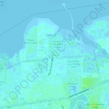
Name: Ojomu topographic map, elevation, terrain.

Location: Ojomu, Eti Osa, Lagos State, Nigeria (6.43504 3.50063 6.47504 3.54063)

Average elevation: 2 m

Minimum elevation: -5 m

Maximum elevation: 10 m

Other topographic maps

Click on a map to view its topography, its elevation and its terrain.

Itirin

Nigeria > Lagos State > Eti Osa

Itirin, Eti Osa, Lagos State, 500001, Nigeria

Average elevation: 4 m

Igbosere

Nigeria > Lagos State > Eti Osa

Igbosere, Eti Osa, Lagos State, 500001, Nigeria

Average elevation: 4 m

Lagos Island

Nigeria > Lagos State > Eti Osa > Igbo

Lagos Island, Igbo, Eti Osa, Lagos State, Nigeria

Average elevation: 3 m

Ajah

Nigeria > Lagos State > Eti Osa

Ajah, Eti Osa, Lagos State, Nigeria

Average elevation: 3 m

Victoria Island

Nigeria > Lagos State > Eti Osa > Apese

Victoria Island, Apese, Eti Osa, Lagos State, 500001, Nigeria

Average elevation: 10 m