
Chihuahua City topographic map
Interactive map
Click on the map to display elevation.
Chihuahua City
Chihuahua lies on the western side of the Chihuahuan Desert ecoregion and as such has a semiarid climate (Köppen climate classification BSh). However, it is not as hot as most of the lower elevated portions of the desert to the east owing to an altitude of almost 1,500 metres (4,900 feet) above sea level.
About this map
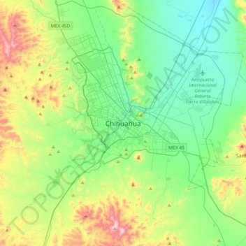
Name: Chihuahua City topographic map, elevation, terrain.
Average elevation: 1,555 m
Minimum elevation: 1,295 m
Maximum elevation: 2,245 m