
Herleshausen topographic map
Interactive map
Click on the map to display elevation.
About this map
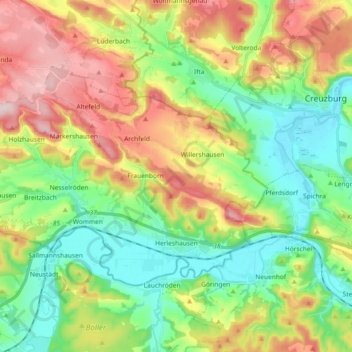
Name: Herleshausen topographic map, elevation, terrain.
Location: Herleshausen, Werra-Meißner-Kreis, Hessen, 37293, Deutschland (50.99342 10.03108 51.06461 10.21467)
Average elevation: 296 m
Minimum elevation: 190 m
Maximum elevation: 465 m