
Almetyevsk topographic map
Interactive map
Click on the map to display elevation.
About this map
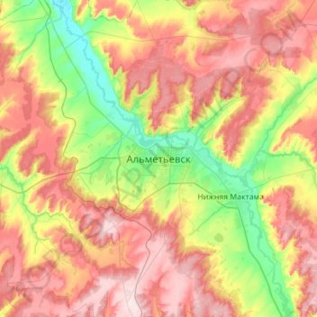
Name: Almetyevsk topographic map, elevation, terrain.
Average elevation: 205 m
Minimum elevation: 82 m
Maximum elevation: 344 m
Other topographic maps
Click on a map to view its topography, its elevation and its terrain.
Almetyevsk
Russia > Tatarstan > Almetyevsk
Almetyevsk, Almetyevsky District, Tatarstan, Volga Federal District, Russia
Average elevation: 167 m