
Brunnen topographic map
Interactive map
Click on the map to display elevation.
About this map
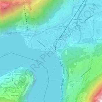
Name: Brunnen topographic map, elevation, terrain.
Location: Brunnen, Ingenbohl, Schwyz, 6440, Schweiz (46.97404 8.58541 47.01404 8.62541)
Average elevation: 592 m
Minimum elevation: 402 m
Maximum elevation: 1,568 m