
Ermsdorf topographic map
Interactive map
Click on the map to display elevation.
About this map
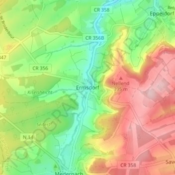
Name: Ermsdorf topographic map, elevation, terrain.
Location: Ermsdorf, Vallée de l'Ernz, Canton Diekirch, 9366, Luxembourg (49.80882 6.20140 49.84882 6.24140)
Average elevation: 322 m
Minimum elevation: 229 m
Maximum elevation: 432 m