
Simgadi topographic map
Interactive map
Click on the map to display elevation.
About this map
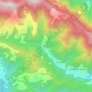
Name: Simgadi topographic map, elevation, terrain.
Location: Simgadi, Garud, Bageshwar, Uttarakhand, India (29.97982 79.62106 30.01982 79.66106)
Average elevation: 1,815 m
Minimum elevation: 1,350 m
Maximum elevation: 2,369 m