Geolocate

Atcham topographic map

Click on the map to display elevation.

About this map

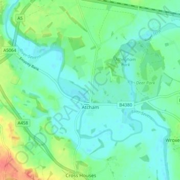
Name: Atcham topographic map, elevation, terrain.

Location: Atcham, Shropshire, West Midlands, England, United Kingdom (52.66371 -2.72758 52.70209 -2.65724)

Average elevation: 56 m

Minimum elevation: 42 m

Maximum elevation: 93 m

Shropshire trails, hiking, mountain biking, running and outdoor activities

Gear up for your next adventure:

🎒Hiking Daypacks - Compact backpacks ideal for short hikes and excursions
🎒Hiking Child Carriers - Explore the outdoors with the whole family safely
💧Hydration Reservoirs - Convenient water bladders for hands-free drinking on the move
👟Heavy Duty Boot Laces - Always carry a spare for your hiking footwear
🪓Outdoor Multitools - Versatile tools for hiking and camping

As an Amazon Associate, this site earns from qualifying purchases at no extra cost to you.