Val des Quatre Pignons topographic map
Interactive map
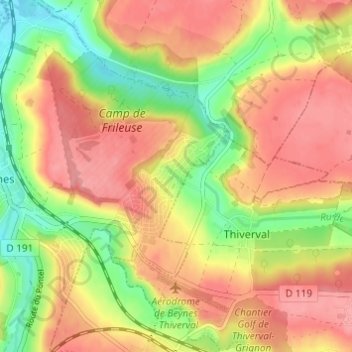
Click on the map to display elevation.
About this map
Name: Val des Quatre Pignons topographic map, elevation, terrain.
Average elevation: 92 m
Minimum elevation: 42 m
Maximum elevation: 128 m

Click on the map to display elevation.
Name: Val des Quatre Pignons topographic map, elevation, terrain.
Average elevation: 92 m
Minimum elevation: 42 m
Maximum elevation: 128 m