
Tshwane Ward 46 topographic map
Interactive map
Click on the map to display elevation.
About this map
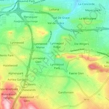
Name: Tshwane Ward 46 topographic map, elevation, terrain.
Average elevation: 1,396 m
Minimum elevation: 1,304 m
Maximum elevation: 1,555 m
Other topographic maps
Click on a map to view its topography, its elevation and its terrain.
Tshwane Ward 85
Tshwane Ward 85, Pretoria, City of Tshwane Metropolitan Municipality, Gauteng, RSA
Average elevation: 1,391 m
Tshwane Ward 77
Tshwane Ward 77, Pretoria, City of Tshwane Metropolitan Municipality, Gauteng, RSA
Average elevation: 1,502 m