Geolocate

Porongurup topographic map

Click on the map to display elevation.

About this map

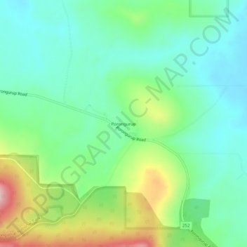
Name: Porongurup topographic map, elevation, terrain.

Location: Porongurup, Albany, Western Australia, Australia (-34.67702 117.87226 -34.63702 117.91226)

Average elevation: 269 m

Minimum elevation: 201 m

Maximum elevation: 426 m

Gear up for your next adventure:

🔦Keychain LED Torches - Emergency backup light for finding gear in your pack
🎿Telescopic Trekking Poles - Reduces knee strain on steep topographic descents
Lightweight Tents - Compact tents for backpacking and trekking
👖Hiking Trousers - Durable trousers designed for rough terrain
🛰️Satellite Messengers - Emergency communication devices for areas without mobile signal

As an Amazon Associate, this site earns from qualifying purchases at no extra cost to you.