
Bachorze topographic map
Interactive map
Click on the map to display elevation.
About this map
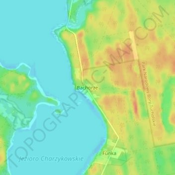
Name: Bachorze topographic map, elevation, terrain.
Average elevation: 129 m
Minimum elevation: 115 m
Maximum elevation: 151 m
Other topographic maps
Click on a map to view its topography, its elevation and its terrain.
Czersk
Poland > Pomeranian Voivodeship > Chojnice County > Czersk
Czersk, gmina Czersk, Chojnice County, Pomeranian Voivodeship, 89-650, Poland
Average elevation: 128 m
Chojnice
Poland > Pomeranian Voivodeship > Chojnice County > Chojnice
Chojnice, Chojnice County, Pomeranian Voivodeship, Poland
Average elevation: 165 m