Geolocate

Barot topographic map

Click on the map to display elevation.

About this map

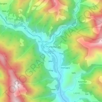
Name: Barot topographic map, elevation, terrain.

Location: Barot, Padhar, Mandi, Himachal Pradesh, 175013, India (32.01773 76.82521 32.05773 76.86521)

Average elevation: 2,151 m

Minimum elevation: 1,770 m

Maximum elevation: 2,716 m

Gear up for your next adventure:

🔪Outdoor Multi-Tools - Versatile tools for gear repairs and food prep in the wild
🔥Emergency Fire Starters - Reliable ignition tools for survival situations in damp conditions
🧥Packable Down Jackets - Lightweight warmth that compresses small in your bag
🧥Waterproof Hiking Jackets - Rain protection for walking in all weather conditions
🍳Camping Stoves - Compact stoves for outdoor cooking

As an Amazon Associate, this site earns from qualifying purchases at no extra cost to you.