
Thank you for supporting this site ❤️
Make a donation
Make a donation
Gear up for your next adventure:
As an Amazon Associate, this site earns from qualifying purchases at no extra cost to you.
Yusmarg topographic map
Click on the map to display elevation.
Thank you for supporting this site ❤️
Make a donation
Make a donation
Gear up for your next adventure:
As an Amazon Associate, this site earns from qualifying purchases at no extra cost to you.
About this map
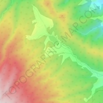
Name: Yusmarg topographic map, elevation, terrain.
Location: Yusmarg, Charar-E-Shrief, Budgam, Jammu and Kashmir, India (33.80139 74.64766 33.84139 74.68766)
Average elevation: 2,424 m
Minimum elevation: 2,154 m
Maximum elevation: 2,687 m
Thank you for supporting this site ❤️
Make a donation
Make a donation
Gear up for your next adventure:
As an Amazon Associate, this site earns from qualifying purchases at no extra cost to you.