
Thank you for supporting this site ❤️
Make a donation
Make a donation
Gear up for your next adventure:
As an Amazon Associate, this site earns from qualifying purchases at no extra cost to you.
Escalera topographic map
Click on the map to display elevation.
Thank you for supporting this site ❤️
Make a donation
Make a donation
Gear up for your next adventure:
As an Amazon Associate, this site earns from qualifying purchases at no extra cost to you.
About this map
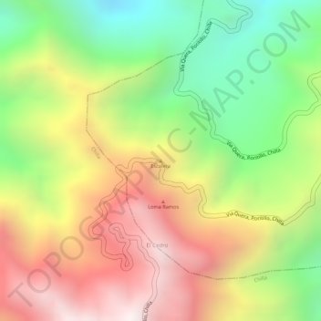
Name: Escalera topographic map, elevation, terrain.
Location: Escalera, Uzhcurrumi, Pasaje, El Oro, Ecuador (-3.38183 -79.58334 -3.38173 -79.58324)
Average elevation: 1,434 m
Minimum elevation: 925 m
Maximum elevation: 1,920 m
Thank you for supporting this site ❤️
Make a donation
Make a donation
Gear up for your next adventure:
As an Amazon Associate, this site earns from qualifying purchases at no extra cost to you.