
Make a donation
Gear up for your next adventure:
As an Amazon Associate, this site earns from qualifying purchases at no extra cost to you.
Piravom topographic map
Click on the map to display elevation.
Make a donation
Gear up for your next adventure:
As an Amazon Associate, this site earns from qualifying purchases at no extra cost to you.
Piravom
Piravom was reverted to panchayat status in 1992 after two years as a municipality because of skepticism that its classification as a municipality would attract higher tax rates and building regulation. However as modern municipal councils now have the authority to fix the tax rate and new building rule provisions are now applicable to special grade panchayats, the economic incentive for Piravom remaining a panchayat has disappeared. The local government of Piravom passed a unanimous resolution for elevation to municipality status. In 2015, the government of Kerala reclassified Piravom as a municipality.
Make a donation
Gear up for your next adventure:
As an Amazon Associate, this site earns from qualifying purchases at no extra cost to you.
About this map
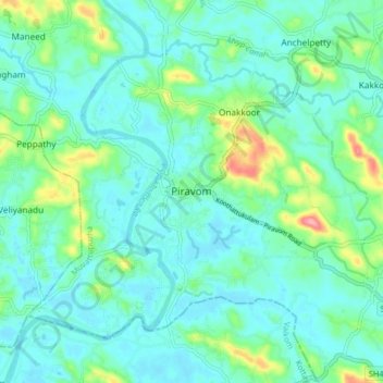
Name: Piravom topographic map, elevation, terrain.
Location: Piravom, Muvattupuzha, Ernakulam district, Kerala, 686664, India (9.83337 76.45227 9.91337 76.53227)
Average elevation: 23 m
Minimum elevation: -1 m
Maximum elevation: 111 m
Make a donation
Gear up for your next adventure:
As an Amazon Associate, this site earns from qualifying purchases at no extra cost to you.