Geolocate

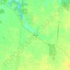
Russellville topographic map

Click on the map to display elevation.

About this map

Name: Russellville topographic map, elevation, terrain.

Location: Russellville, Jefferson Township, Brown County, Ohio, United States (38.85769 -83.79664 38.87742 -83.77712)

Average elevation: 288 m

Minimum elevation: 260 m

Maximum elevation: 302 m

Other topographic maps

Click on a map to view its topography, its elevation and its terrain.

Feesburg

United States > Ohio > Brown County

Average elevation: 280 m

Chasetown

United States > Ohio > Brown County

Average elevation: 288 m

Yankeetown

United States > Ohio > Brown County

Average elevation: 284 m

Gear up for your next adventure:

🧥Waterproof Hiking Jackets - Rain protection for walking in all weather conditions
🥼Base Layers - Thermal base layers for temperature regulation
🧦Merino Wool Hiking Socks - Moisture-wicking socks to prevent blisters during long mountain walks
🗺️Topographic Maps - Detailed maps showing elevation and terrain features
📢Survival Whistles - Essential safety gear for signaling for help in mountain fog

As an Amazon Associate, this site earns from qualifying purchases at no extra cost to you.