
Zhemgang District topographic map
Interactive map
Click on the map to display elevation.
About this map
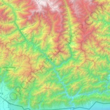
Name: Zhemgang District topographic map, elevation, terrain.
Location: Zhemgang District, Bhutan (26.78261 90.51718 27.37901 91.18458)
Average elevation: 1,620 m
Minimum elevation: 84 m
Maximum elevation: 4,581 m
Other topographic maps
Click on a map to view its topography, its elevation and its terrain.
Tingtibi
Bhutan > Zhemgang District > Trong Gewog > Tingtibi
Tingtibi, Trong Gewog, Zhemgang District, Bhutan
Average elevation: 776 m