
Kaneri topographic map
Interactive map
Click on the map to display elevation.
About this map
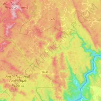
Name: Kaneri topographic map, elevation, terrain.
Location: Kaneri, Supa taluk, Uttara Kannada, Karnataka, 581187, India (15.02371 74.32723 15.13608 74.60427)
Average elevation: 519 m
Minimum elevation: 57 m
Maximum elevation: 1,030 m
Other topographic maps
Click on a map to view its topography, its elevation and its terrain.
Maulangi
India > Karnataka > Supa taluk
Maulangi, Supa taluk, Uttara Kannada, Karnataka, 581365, India
Average elevation: 483 m