
Jeizinen topographic map
Interactive map
Click on the map to display elevation.
About this map
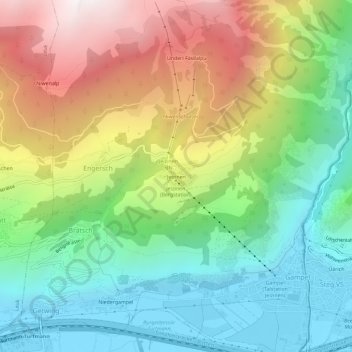
Name: Jeizinen topographic map, elevation, terrain.
Location: Jeizinen, Engersch, Gampel-Bratsch, Leuk, Wallis, 3957, Schweiz (46.30679 7.70304 46.34679 7.74304)
Average elevation: 1,299 m
Minimum elevation: 622 m
Maximum elevation: 2,405 m