
Aber topographic map
Interactive map
Click on the map to display elevation.
About this map
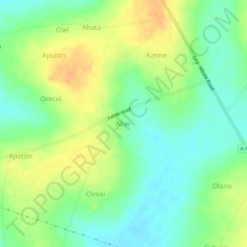
Name: Aber topographic map, elevation, terrain.
Location: Aber, Soroti, Eastern Region, Uganda (1.81892 33.45794 1.85892 33.49794)
Average elevation: 1,056 m
Minimum elevation: 1,040 m
Maximum elevation: 1,075 m