
Hassi Ouden topographic map
Interactive map
Click on the map to display elevation.
About this map
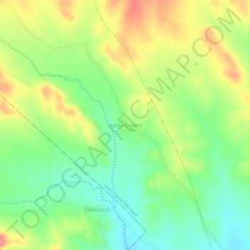
Name: Hassi Ouden topographic map, elevation, terrain.
Location: Hassi Ouden, Slim, Djebel Messaad District, M'Sila, Algeria (34.86885 4.06563 34.90885 4.10563)
Average elevation: 1,041 m
Minimum elevation: 998 m
Maximum elevation: 1,097 m
Other topographic maps
Click on a map to view its topography, its elevation and its terrain.