
Villagrán topographic map
Interactive map
Click on the map to display elevation.
About this map
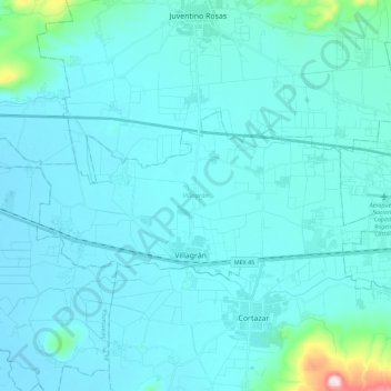
Name: Villagrán topographic map, elevation, terrain.
Location: Villagrán, Guanajuato, México (20.50064 -101.11188 20.59165 -100.88654)
Average elevation: 1,754 m
Minimum elevation: 1,718 m
Maximum elevation: 2,196 m
Other topographic maps
Click on a map to view its topography, its elevation and its terrain.
Uriangato
México > Guanajuato > Uriangato
Uriangato, Guanajuato, 38980, México
Average elevation: 1,917 m