
Algora topographic map
Interactive map
Click on the map to display elevation.
About this map
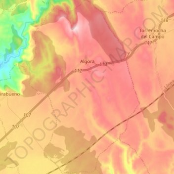
Name: Algora topographic map, elevation, terrain.
Location: Algora, Guadalajara, Castile-La Mancha, Spain (40.90024 -2.71042 40.99612 -2.62805)
Average elevation: 1,084 m
Minimum elevation: 882 m
Maximum elevation: 1,209 m
Other topographic maps
Click on a map to view its topography, its elevation and its terrain.