Geolocate

Dunfermline topographic map

Click on the map to display elevation.

About this map

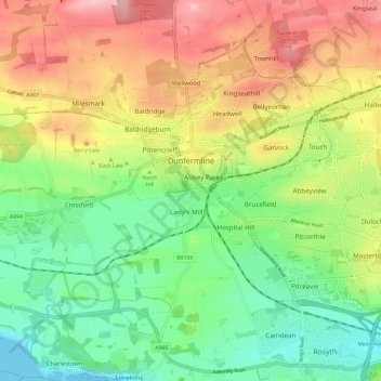
Name: Dunfermline topographic map, elevation, terrain.

Location: Dunfermline, Fife, Scotland, United Kingdom (56.04430 -3.50324 56.08817 -3.38688)

Average elevation: 80 m

Minimum elevation: 0 m

Maximum elevation: 191 m

Fife trails, hiking, mountain biking, running and outdoor activities

Gear up for your next adventure:

🎿Telescopic Trekking Poles - Reduces knee strain on steep topographic descents
Altimeter Watches - Watches measuring altitude for mountain activities
🧺Mesh Stuff Sacks - Breathable storage for wet gear or camp organization
🔋Solar Power Banks - Keep your GPS and phone charged during multi-day expeditions
🎒Replacement Sternum Straps - Repair parts for hiking rucksacks

As an Amazon Associate, this site earns from qualifying purchases at no extra cost to you.