
بلوچ topographic map
Interactive map
Click on the map to display elevation.
About this map
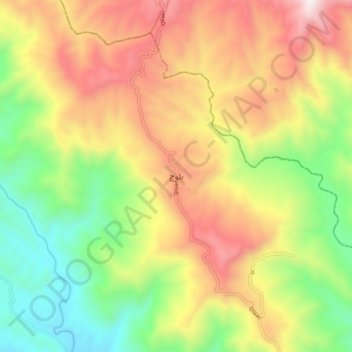
Name: بلوچ topographic map, elevation, terrain.
Location: بلوچ, ضلع سدھنوتی, Azad Cachemire, Pakistan (33.60592 73.77583 33.68592 73.85583)
Average elevation: 1,316 m
Minimum elevation: 724 m
Maximum elevation: 2,012 m
Other topographic maps
Click on a map to view its topography, its elevation and its terrain.
Seri
Pakistan > Azad Cachemire > Athmuqam
Seri, Athmuqam, District de la Vallée de Neelam, مظفرآباد ڈویژن, Azad Cachemire, Pakistan
Average elevation: 2,824 m