
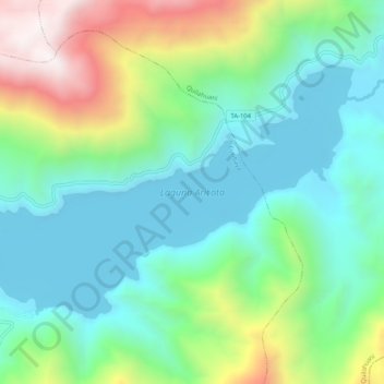
Laguna Aricota topographic map
Interactive map
Click on the map to display elevation.
About this map
Name: Laguna Aricota topographic map, elevation, terrain.
Average elevation: 3,058 m
Minimum elevation: 2,724 m
Maximum elevation: 3,863 m
Lake Aricota (possibly from Aymara ari pointed, sharp, quta lake) is a lake in Candarave Province, region of Tacna, Peru. It has an elevation of 2,800 metres (9,186 ft) above sea level.