
Thank you for supporting this site ❤️
Make a donation
Make a donation
Gear up for your next adventure:
As an Amazon Associate, this site earns from qualifying purchases at no extra cost to you.
Limoncarro topographic map
Click on the map to display elevation.
Thank you for supporting this site ❤️
Make a donation
Make a donation
Gear up for your next adventure:
As an Amazon Associate, this site earns from qualifying purchases at no extra cost to you.
About this map
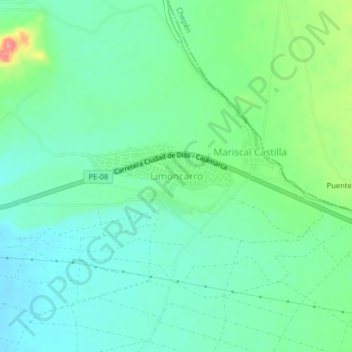
Name: Limoncarro topographic map, elevation, terrain.
Location: Limoncarro, Guadalupe, Pacasmayo, La Libertad, Perú (-7.32186 -79.43650 -7.28186 -79.39650)
Average elevation: 118 m
Minimum elevation: 91 m
Maximum elevation: 190 m
Thank you for supporting this site ❤️
Make a donation
Make a donation
Gear up for your next adventure:
As an Amazon Associate, this site earns from qualifying purchases at no extra cost to you.