
Fremont topographic map
Interactive map
Click on the map to display elevation.
Fremont
On August 10, 1959, a Boeing B-52 Stratofortress crashed in Fremont. The aircraft, serial number 54-2682, had departed Westover Air Force Base in Chicopee, Massachusetts. During flight at 34,000 feet (10,000 m), the crew heard several loud bangs, the radar system became inoperative, and the plane began to vibrate. As the vibrations became more severe, the plane began to lose altitude, and the pilot ordered the crew to bail out at 14,000 feet (4,300 m). The pilot remained with the aircraft for several additional minutes, then ejected. The plane crashed into Spruce Swamp at 2:50 p.m. local time. The pilot and seven crew members all survived. The crash was attributed to a failure of the radome on the nose of the aircraft.
About this map
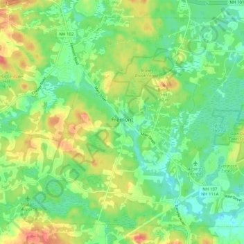
Name: Fremont topographic map, elevation, terrain.
Average elevation: 58 m
Minimum elevation: 34 m
Maximum elevation: 97 m
Other topographic maps
Click on a map to view its topography, its elevation and its terrain.
Chester
United States > New Hampshire > Rockingham County
According to the United States Census Bureau, the town has a total area of 26.1 square miles (67.7 km2), of which 26.0 square miles (67.4 km2) are land and 0.12 square miles (0.3 km2), or 0.43%, are water. The highest point in town is found on an unnamed hill west of Bell Hill and northwest of Harantis Lake;…
Average elevation: 112 m
Salem Depot
United States > New Hampshire > Rockingham County > Salem > Salem Depot
Average elevation: 50 m
Rye Beach Village District
United States > New Hampshire > Rockingham County > Rye Beach Village District
Average elevation: 7 m
Newmarket
United States > New Hampshire > Rockingham County > Newmarket
According to the United States Census Bureau, the town has a total area of 14.2 square miles (36.7 km2), of which 12.6 square miles (32.6 km2) are land and 1.6 square miles (4.1 km2) are water, comprising 11.24% of the town. Situated beside Great Bay, Newmarket is drained by the Lamprey River and its…
Average elevation: 21 m
Newington
United States > New Hampshire > Rockingham County
According to the United States Census Bureau, the town has a total area of 12.4 square miles (32.0 km2), of which 8.1 square miles (21.0 km2) are land and 4.2 square miles (11.0 km2) are water, comprising 34.5% of the town. The highest elevation in Newington is 130 feet (40 m) above sea level, near Newington…
Average elevation: 10 m
Stratham
United States > New Hampshire > Rockingham County
According to the United States Census Bureau, the town has a total area of 15.5 square miles (40.2 km2), of which 15.1 square miles (39.2 km2) are land and 0.3 square miles (0.9 km2) are water, comprising 2.29% of the town. Most of Stratham is drained by the Squamscott River, a north-flowing tributary of Great…
Average elevation: 22 m