
Thank you for supporting this site ❤️
Make a donation
Make a donation
Gear up for your next adventure:
As an Amazon Associate, this site earns from qualifying purchases at no extra cost to you.
Tscheyegg topographic map
Click on the map to display elevation.
Thank you for supporting this site ❤️
Make a donation
Make a donation
Gear up for your next adventure:
As an Amazon Associate, this site earns from qualifying purchases at no extra cost to you.
About this map
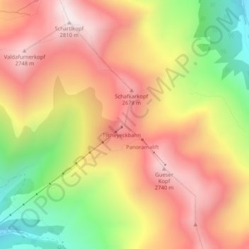
Name: Tscheyegg topographic map, elevation, terrain.
Location: Tscheyegg, Gemeinde Nauders, Bezirk Landeck, Tyrol, Austria (46.88879 10.57071 46.88889 10.57081)
Average elevation: 2,409 m
Minimum elevation: 1,915 m
Maximum elevation: 2,788 m
Thank you for supporting this site ❤️
Make a donation
Make a donation
Gear up for your next adventure:
As an Amazon Associate, this site earns from qualifying purchases at no extra cost to you.