Geolocate

Lukula topographic map

Click on the map to display elevation.

About this map

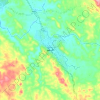
Name: Lukula topographic map, elevation, terrain.

Location: Lukula, Kongo Central, Democratic Republic of the Congo (-5.43830 12.90522 -5.35830 12.98522)

Average elevation: 144 m

Minimum elevation: 84 m

Maximum elevation: 268 m

Gear up for your next adventure:

🥤Collapsible Water Bottles - Save space in your rucksack as you consume your water
👟Women's Trail Running Shoes - Agile footwear for fell running and technical trails
🧵Survival Paracord - Multi-purpose cordage for emergency repairs and shelters
🥾Hiking Boots - Waterproof and durable boots for long-distance hiking in the UK
🧦Hiking Socks - Breathable socks designed to prevent blisters on long walks

As an Amazon Associate, this site earns from qualifying purchases at no extra cost to you.