
Astara District topographic map
Interactive map
Click on the map to display elevation.
About this map
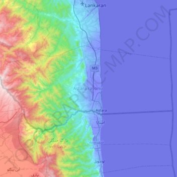
Name: Astara District topographic map, elevation, terrain.
Location: Astara District, Lankaran-Astara, Azerbaijan (38.39296 48.48873 38.63850 49.13711)
Average elevation: 365 m
Minimum elevation: -30 m
Maximum elevation: 2,193 m
Other topographic maps
Click on a map to view its topography, its elevation and its terrain.