
Villahermosa topographic map
Interactive map
Click on the map to display elevation.
About this map
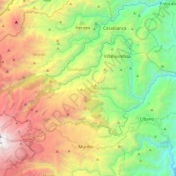
Name: Villahermosa topographic map, elevation, terrain.
Location: Villahermosa, Nevados, Tolima, Colombia (4.88767 -75.32034 5.06718 -75.01490)
Average elevation: 2,017 m
Minimum elevation: 634 m
Maximum elevation: 4,128 m