Geolocate

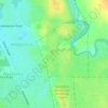
West End topographic map

Click on the map to display elevation.

About this map

Name: West End topographic map, elevation, terrain.

Location: West End, Geraldton, City Of Greater Geraldton, Western Australia, 6530, Australia (-28.78693 114.57598 -28.76924 114.60236)

Average elevation: 2 m

Minimum elevation: -2 m

Maximum elevation: 21 m

Other topographic maps

Click on a map to view its topography, its elevation and its terrain.
Muir Park

Australia > Western Australia > Geraldton

Average elevation: 21 m

Gear up for your next adventure:

🔦Outdoor Torches - Reliable torches for night navigation
📐Altimeters & Barometers - Tools for measuring altitude and air pressure
🧊Insulated Flasks - Keeps drinks hot or cold during hikes
🧵Survival Paracord - Multi-purpose cordage for emergency repairs and shelters
🕶️Polarized Sunglasses - Reduces glare from snow and water when reading terrain

As an Amazon Associate, this site earns from qualifying purchases at no extra cost to you.