Geolocate

Kecskemét topographic map

Interactive map

Click on the map to display elevation.

About this map

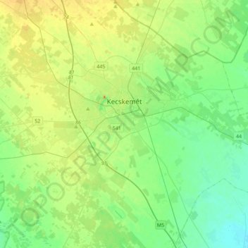
Name: Kecskemét topographic map, elevation, terrain.

Location: Kecskemét, Kecskeméti járás, Bács-Kiskun, South Great Plain, Great Plain and North, Hungary (46.76992 19.50680 47.00125 19.85177)

Average elevation: 116 m

Minimum elevation: 95 m

Maximum elevation: 161 m

Kecskemét was established at the meeting point of a large sandy region and a sandy yellow soil; its elevation is 120 m (394 ft) above sea level. The territory west of the city is covered by wind-blown sand, characterised by the almost parallel northern-southern sand dunes and the plain between them. At the end of the 18th and the beginning of the 19th centuries, the pastures had become depleted. Overgrazing by cattle had destroyed the natural vegetation cover, and the movement of sand seriously endangered the town. Concentrated reforestation and planting of fruit and vines was carried out to stabilise the soil again.

Wikipedia (CC-BY-SA 3.0)

Other topographic maps

Click on a map to view its topography, its elevation and its terrain.

Harta

Hungary > Bács-Kiskun

Harta, Kalocsai járás, Bács-Kiskun, South Great Plain, Great Plain and North, Hungary

Average elevation: 95 m

Dunapataj

Hungary > Bács-Kiskun

Dunapataj, Kalocsai járás, Bács-Kiskun, South Great Plain, Great Plain and North, 6328, Hungary

Average elevation: 95 m

Zab-szék

Hungary > Bács-Kiskun > Szabadszállás

Zab-szék, Szabadszállás, Kunszentmiklósi járás, Bács-Kiskun, South Great Plain, Great Plain and North, Hungary

Average elevation: 93 m

Upper Kiskunság Alkaline Lakes

Hungary > Bács-Kiskun > Fülöpszállás

Upper Kiskunság Alkaline Lakes, Fülöpszállás, Kiskőrösi járás, Bács-Kiskun, South Great Plain, Great Plain and North, 6085, Hungary

Average elevation: 95 m

Kalocsa

Hungary > Bács-Kiskun

Kalocsa, Kalocsai járás, Bács-Kiskun, South Great Plain, Great Plain and North, 6300, Hungary

Average elevation: 91 m

Golgota

Hungary > Bács-Kiskun > Lajosmizse

Golgota, Lajosmizse, Kecskeméti járás, Bács-Kiskun, South Great Plain, Great Plain and North, 6050, Hungary

Average elevation: 136 m

Bajai járás

Hungary > Bács-Kiskun

Bajai járás, Bács-Kiskun, South Great Plain, Great Plain and North, Hungary

Average elevation: 111 m

Lajosmizse

Hungary > Bács-Kiskun > Lajosmizse

Lajosmizse, Kecskeméti járás, Bács-Kiskun, Southern Great Plain, Great Plain and North, 6050, Hungary

Average elevation: 133 m

Dunafalva

Hungary > Bács-Kiskun > Dunafalva > Dunafalva

Dunafalva, Bajai járás, Bács-Kiskun, Southern Great Plain, Great Plain and North, 6513, Hungary

Average elevation: 97 m