
Paraguarí topographic map
Interactive map
Click on the map to display elevation.
About this map
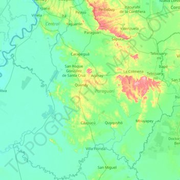
Name: Paraguarí topographic map, elevation, terrain.
Location: Paraguarí, Región Oriental, Paraguay (-26.61968 -57.74899 -25.40178 -56.60904)
Average elevation: 107 m
Minimum elevation: 48 m
Maximum elevation: 558 m
Other topographic maps
Click on a map to view its topography, its elevation and its terrain.