
Lac Foch topographic map
Interactive map
Click on the map to display elevation.
About this map
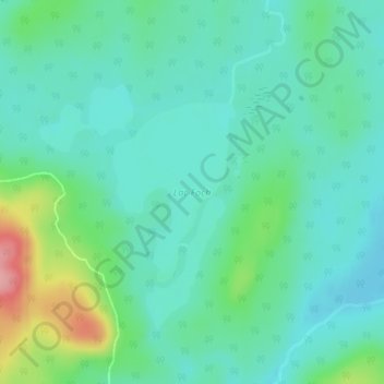
Name: Lac Foch topographic map, elevation, terrain.
Average elevation: 429 m
Minimum elevation: 399 m
Maximum elevation: 524 m
Other topographic maps
Click on a map to view its topography, its elevation and its terrain.
Lac O'Sullivan
Canada > Québec > La Vallée-de-la-Gatineau > Lac-Lenôtre
Lac O'Sullivan, Lac-Lenôtre, La Vallée-de-la-Gatineau, Outaouais, Québec, Canada
Average elevation: 421 m
Lac Tedder
Canada > Québec > La Vallée-de-la-Gatineau > Lac-Lenôtre
Lac Tedder, Lac-Lenôtre, La Vallée-de-la-Gatineau, Outaouais, Québec, Canada
Average elevation: 412 m
Lac Jasper
Canada > Québec > La Vallée-de-la-Gatineau > Lac-Lenôtre
Lac Jasper, Lac-Lenôtre, La Vallée-de-la-Gatineau, Outaouais, Québec, Canada
Average elevation: 423 m