
Thank you for supporting this site ❤️
Make a donation
Make a donation
Gear up for your next adventure:
As an Amazon Associate, this site earns from qualifying purchases at no extra cost to you.
Lusevera topographic map
Click on the map to display elevation.
Thank you for supporting this site ❤️
Make a donation
Make a donation
Gear up for your next adventure:
As an Amazon Associate, this site earns from qualifying purchases at no extra cost to you.
About this map
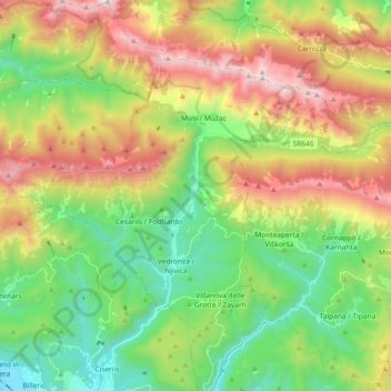
Name: Lusevera topographic map, elevation, terrain.
Location: Lusevera, Udine, Friuli-Venezia Giulia, 33010, Italy (46.24307 13.19825 46.33235 13.38203)
Average elevation: 851 m
Minimum elevation: 193 m
Maximum elevation: 1,900 m
Thank you for supporting this site ❤️
Make a donation
Make a donation
Gear up for your next adventure:
As an Amazon Associate, this site earns from qualifying purchases at no extra cost to you.