
Villa García topographic map
Interactive map
Click on the map to display elevation.
About this map
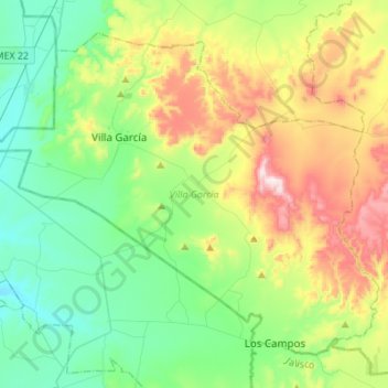
Name: Villa García topographic map, elevation, terrain.
Location: Villa García, Zacatecas, 98900, México (22.01998 -102.04522 22.23075 -101.77142)
Average elevation: 2,170 m
Minimum elevation: 1,975 m
Maximum elevation: 2,602 m
Other topographic maps
Click on a map to view its topography, its elevation and its terrain.